


Description
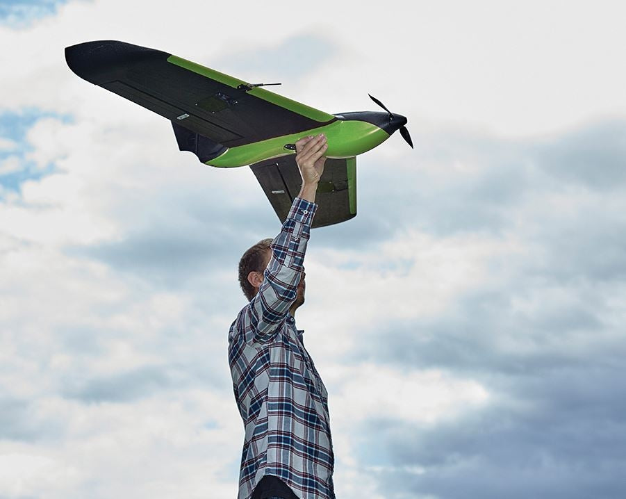
Revolutionize your aerial data collection and unlock unparalleled insights with the Sentera PHX Fixed-Wing Drone (SKU 51142-00) – a highly reliable, incredibly easy-to-use, and hand-launchable fixed-wing drone that provides live HD video and captures a vast array of critical analytic data, including stand counts, weed locations, and plant health, making it the best-performing and best-valued professional fixed-wing drone available today for growers, ag professionals, non-profit organizations, and community leaders!

Command Your Domain: The Ultimate Fixed-Wing Drone for Intelligent Data and Thriving Communities
Are you a grower, an agronomist, an agricultural professional, a non-profit organization involved in environmental monitoring or disaster relief, a school or university conducting advanced geospatial research, a religious establishment managing large properties, a community center overseeing green initiatives, or an apartment complex/Homeowners Association managing extensive grounds? Imagine effortlessly covering vast areas with precision, gaining deep analytics like stand counts and weed locations early in the growing season, and viewing live HD video, all from a robust, hand-launchable drone. The Sentera PHX Fixed-Wing Drone is more than just an aircraft; it's a game-changing solution engineered to deliver industry-leading outcomes, providing you with actionable insights to optimize resource allocation, enhance environmental stewardship, and make informed decisions that impact your operations and community.
Benefits That Drive Unprecedented Efficiency and Transform Insights into Action
This isn't just a drone; it's a transformative investment in your operational efficiency, data accuracy, and ultimate success, offering:
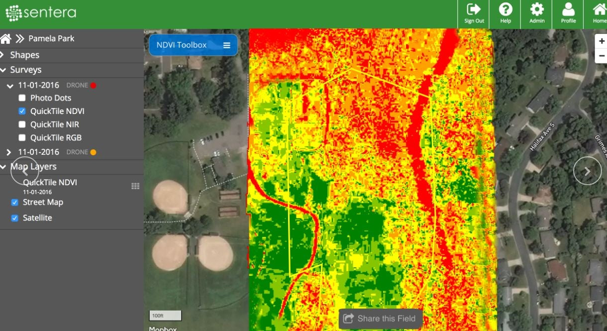
- Gain Deep, Actionable Analytics for Smart Decision-Making: The PHX, leveraging purpose-built payload options like the newest variants of the Sentera Double 4K sensor, allows you to perform stand count, weed detection, and plant health analytics. It's the only fixed-wing drone that maps stand counts and weed locations early in the growing season when action truly matters, empowering you to address fertilizer, pesticide, and herbicide needs based on real-time data for precise and timely interventions.
- Cover Vast Areas with Unmatched Speed and Endurance: With a cruise speed of 35mph and up to 59-minute endurance, the PHX is capable of covering broad areas that other drones of the same size cannot. In a single flight, the PHX can collect data from 700 acres, significantly increasing operational efficiencies for large-scale agricultural surveys, land management, or expansive site inspections.
- Extend Your Reach with Long-Range, Reliable Communication: Utilizing a new long-range omnidirectional communication link, the PHX has a remarkable reach of 2+ miles. This capability is incredibly helpful for users with BVLOS (Beyond Visual Line of Sight) permissions and provides immense operational flexibility for the average user staying within the typical one-mile VLOS range, allowing you to scout large fields with precision from a safe distance.
- Rapid Deployment for Immediate Action: A small, lightweight, plug-and-play communication box and a streamlined pre-flight checklist enable you to easily go from setup to launch quickly and easily. This fast setup is critical for timely interventions, emergency response, or when operating in dynamic environments where every moment counts.
- Optimize Resource Use and Reduce Waste: By providing granular data on plant health, stand counts, and weed locations, the PHX helps users accurately address fertilizer, pesticide, and herbicide needs. This leads to highly targeted applications, reducing chemical use, saving costs, and promoting more sustainable and environmentally friendly practices that benefit both your bottom line and the planet.
- Capture Comprehensive Data in a Single Flight: Depending on the payload variant ordered, the PHX allows operators to capture RGB, NIR, NDVI, and NDRE imagery in a single flight, providing a holistic view of crop health and environmental conditions for deeper insights and more informed decisions.
The Advantage of Versatile Payload Options, Intuitive Software, and Robust Design
The Sentera PHX Fixed-Wing Drone stands out with its intelligent engineering and unwavering commitment to professional reliability:
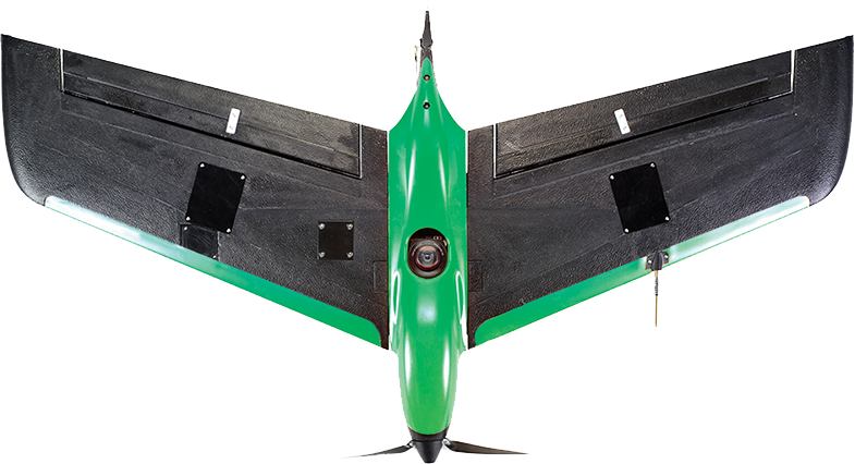
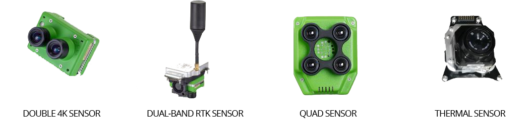
- Hot-Swappable Payload for Diverse Applications: The PHX is hot-swappable, accepting several different sensor types, including ultra-precise RTK GPS Double 4K sensor payloads. This modularity means you can adapt your drone for a multitude of applications, from search and rescue operations to infrastructure inspections to crop health surveys, making it a truly versatile investment.
- Seamless Data Management with FieldAgent™: This drone integrates seamlessly with Sentera FieldAgent™ web, mobile, and desktop software to further augment efficiencies. PHX users can create accurate maps and make decisions at the field edge without an internet connection, ensuring continuous workflow and accessibility of critical data.
- Industry Agnostic for Broad Utility: Sentera developed three distinct PHX variants that include the PHX drone, precision sensor, and all ground control software needed to get up and running, optimizing solutions across various industries. While excelling in agriculture, its precision and data capture capabilities make it invaluable for many other applications.
- Easy-to-Use Flight Software: The intuitive flight software is compatible with Windows, iOS, Android, and Mac operating systems. This flexibility and easy comprehension of the ground control software ensure that the PHX solution will effortlessly integrate into your existing operation, minimizing learning curves and maximizing user adoption.
- High-Precision Imagery for Detailed Analysis: The precision with which the PHX flies and the accuracy of Sentera’s sensors are changing the way industries approach remote sensing technology. You can effortlessly capture high-precision, high-resolution color, NIR, and NDVI data. Captured data may be used to create detailed 3D maps, assisting geospatial analysts, engineers, inspectors, and first responders with measuring geographical volumes, analyzing surface data, and planning for contingencies.
- Proven and Next-Generation Platform: The PHX is the next generation of the proven Sentera PHX fixed-wing platform, building on a legacy of reliability and performance to deliver an even more advanced and capable drone.
Key Features for Superior Fixed-Wing Drone Performance
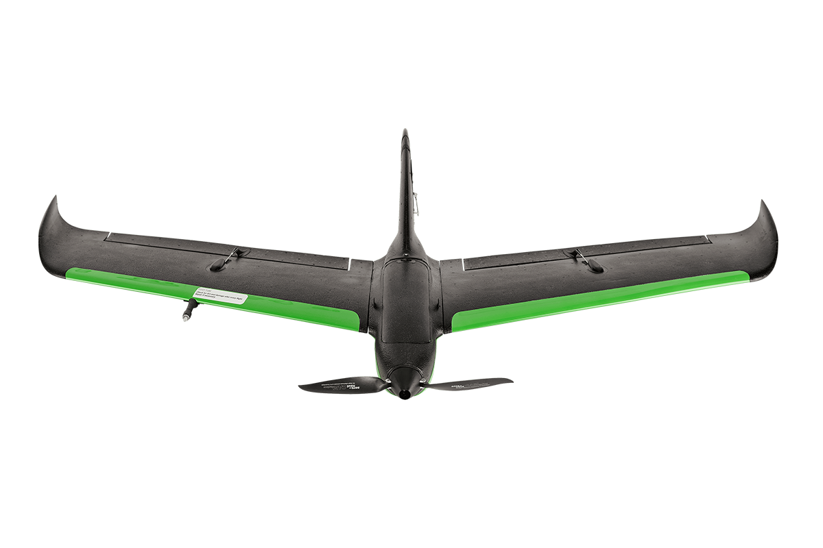
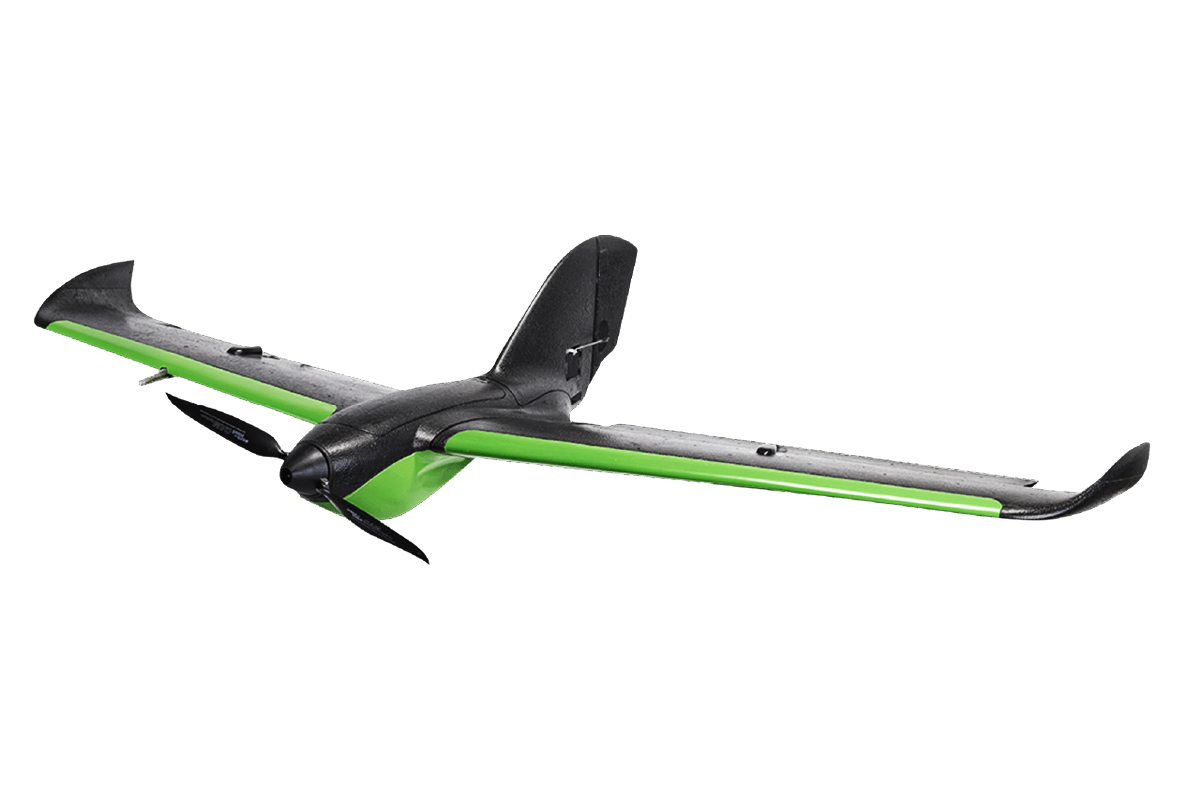
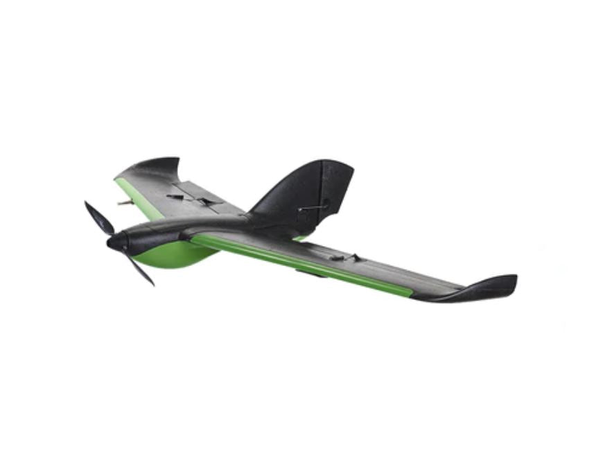
- Drone Type: Hand-launchable fixed-wing drone.
- Payload Compatibility: Accepts newest variants of Sentera Double 4K sensors (including ultra-precise RTK GPS Double 4K sensor payloads).
- Communication Link: New long-range omnidirectional industrial-grade communication link.
- Range: 2+ miles.
- Cruise Speed: 35mph.
- Endurance: Up to 59 minutes.
- Coverage: Capable of collecting data from 700 acres in a single flight.
- Analytics: Purpose-built payload options for stand count, weed detection, and plant health analytics (including RGB, NIR, NDVI, NDRE imagery depending on payload).
- Software Integration: Seamlessly integrates with Sentera FieldAgent™ web, mobile, and desktop software.
- Setup: Fast, streamlined pre-flight checklist, plug-and-play communication box.
- Flight Software Compatibility: Windows, iOS, Android, Mac operating systems.
- Imagery Output: High-precision, high-resolution color, NIR, and NDVI data; capable of creating detailed 3D maps.
- Applications: Agriculture (stand counts, weed detection, plant health), search and rescue, infrastructure inspections, geospatial analysis, engineering, first response.
- Warranty: Manufacturer warranty included.
Invest in Unrivaled Aerial Intelligence with Absolute Confidence
Your investment in the Sentera PHX Fixed-Wing Drone is fully protected by a comprehensive manufacturer warranty, providing you with complete peace of mind. At The Advantage Empire, we believe in creating spaces that grow a sense of community, and with this revolutionary fixed-wing platform, you're not just acquiring a drone; you're gaining the power to cultivate thriving crops, manage vast lands, respond to emergencies, and make data-driven decisions that foster healthier, more productive environments, delivering truly transformative results that make lives better. Equip your team with the ultimate tool for precision aerial data collection. Contact us today to unlock the exhilarating potential of the Sentera PHX Fixed-Wing Drone and redefine what's possible from the sky!
Payment & Security
Your payment information is processed securely. We do not store credit card details nor have access to your credit card information.
Let customers speak for us
purchased two NT-9s ancalled me straight away to confirm details. Arrived in a few days with tracking! need to order 1 more lift from advantage empire guys, keep up the great work
- eyde
It is everything we expected. Works great.

Ry was great to work with. Fast delivery and excellent follow-up. Would definitely recommend. We hope to do business again in the future.
Looks great. Haven't set it up yet though.

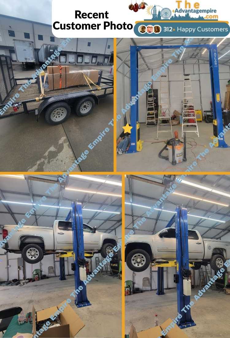
Atlas 10,000 lb Overhead 2 Post Lift SKU ATEXH-PV10PX

Couldn't be more pleased, great service and attention to shipping updates. Equipment excelent and easy to set up. Great fo home use. Delivered in just a few days.
Got this KT-710G tire balancer and it is perfect for my needs as my garage is only 1 bay, this machine can be moved into place and moved back to its storage space. Assembly was straight forward and the tire calibration went as expected. I then balanced my calibration tire to zero. Very impressed with it overall. The Advantage Empire guys really took care of me with a discount and they worked with me on shipping. Overall a solid investment for my home garage.

Not much will beat this balancer. Shipped fast. easy to put together. Works right out of the case. Th only thing that beats this balancer is the customer service you get at The Advantage Empire. Nothing beats that. Thanks Obdi. We will work together soon.
David
Purchased a tire machine and wheel balancer. The balancer turned out to be defective. Obdi was behind me All the way getting it returned. I am ordering a replacement from him. If you are looking for auto equipment buy them from Obdi. He has your back if something goes wrong and will make a good deal for you.

easy to setup, fast delivery + best price, will definitely be shoppin here again

Quick service and, easy communication with the team
I had the best experience ever in the purchasing process. They were easy to deal with and very responsive to my questions.

great service and responsive team, happy with eveyrthing

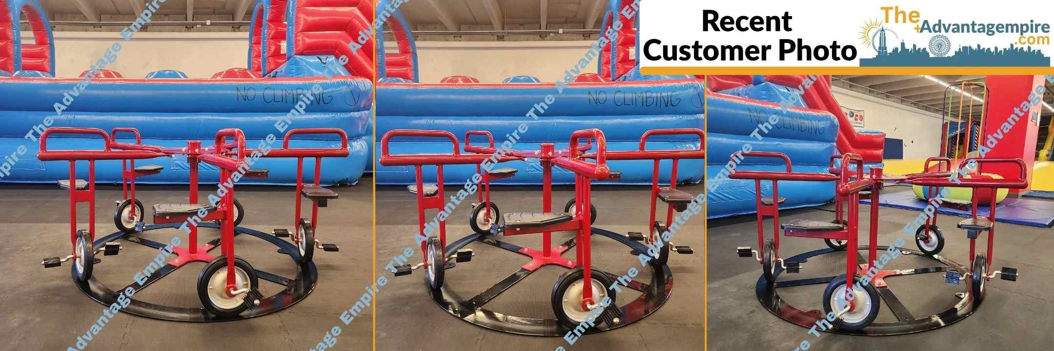
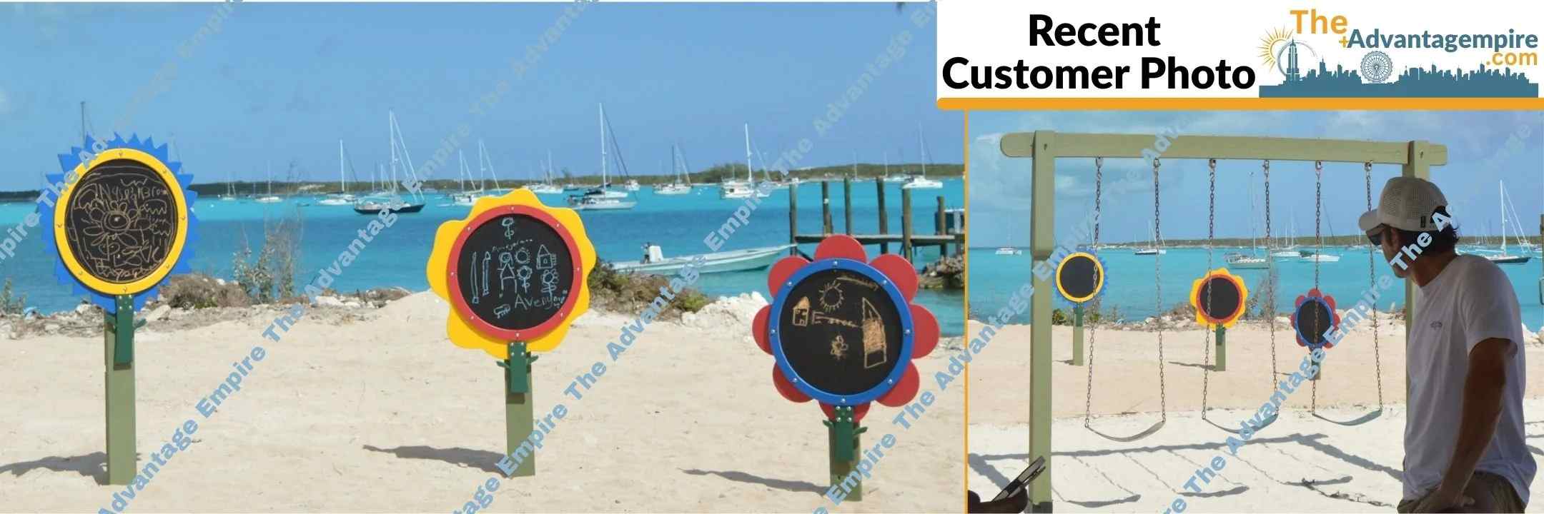
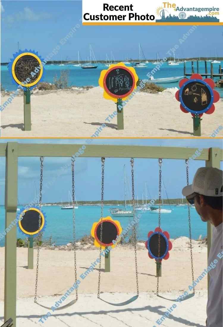
This gaga provides everything our youth sports league needs in one area. It's robust, well-designed, and has held up perfectly to constant use.

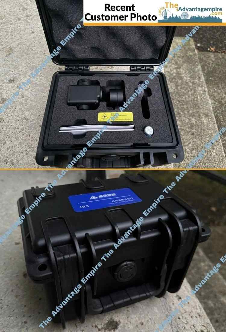
great for search and rescue operations. It's robust and performs well in various conditions. Highly recommend.
