
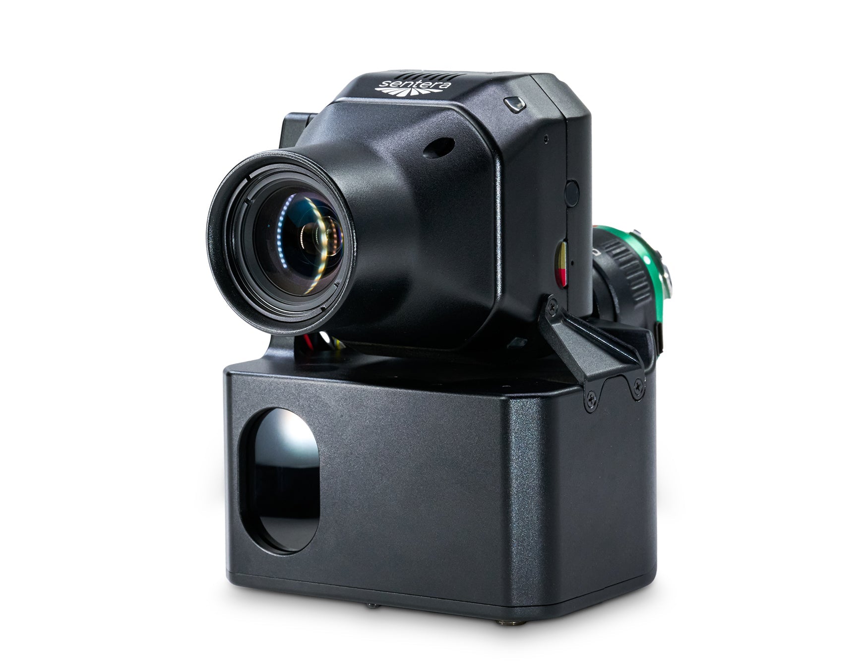

Description
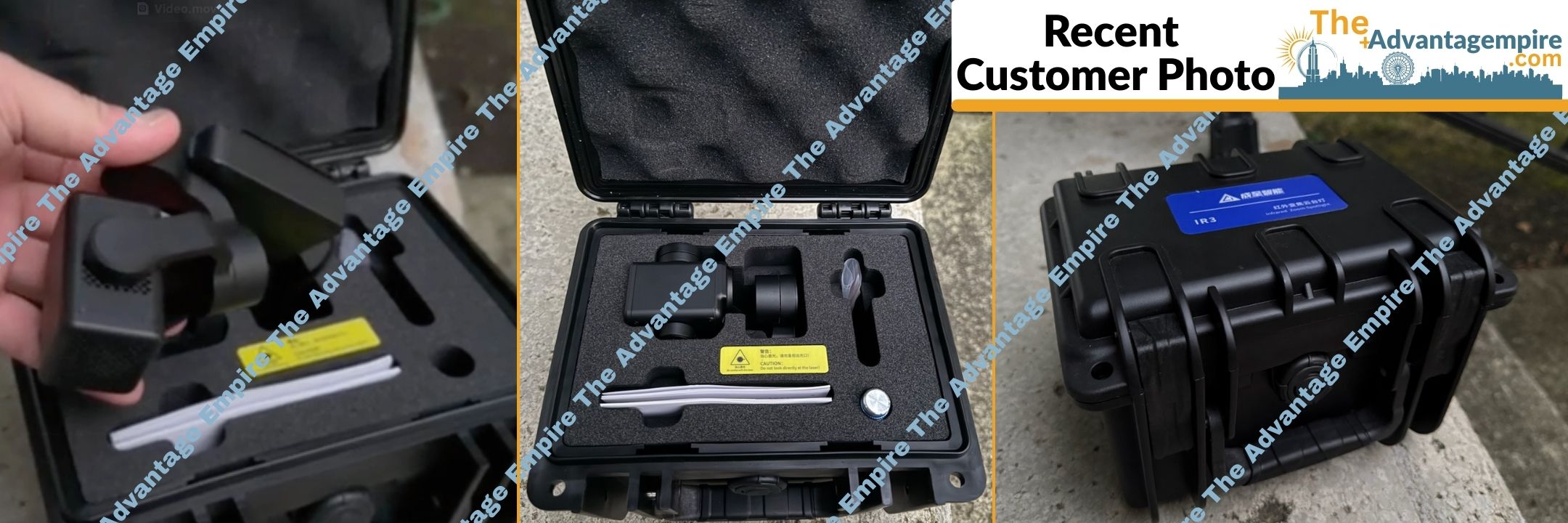
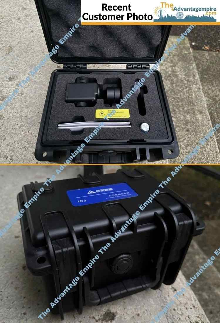
Unleash unparalleled aerial mapping precision and revolutionize your large-scale data acquisition with the Sentera 65R Direct Georeferencing System, M300/350 (SKU 21246-00) – the ultimate solution for delivering high-precision location certainty and ultra-high-resolution aerial maps in minutes, without the need for ground control or stitching, empowering professionals, non-profit organizations, and community leaders to achieve unprecedented speed, accuracy, and efficiency in their geospatial operations, fostering thriving, meticulously managed communities!
Command Your Data: The Ultimate DGR and High-Resolution Sensor for Uncompromising Aerial Mapping and Efficiency
Are you a surveying and mapping professional, an industrial inspection firm, a non-profit organization conducting detailed site assessments or asset management, a university or school with advanced geospatial research programs, a religious establishment managing extensive properties, a community center involved in land planning, a park manager overseeing vast natural areas, or an apartment complex/Homeowners Association managing extensive grounds? Imagine capturing breathtakingly sharp imagery with unmatched detail, generating spatially accurate maps at the field's edge, and covering immense areas in a fraction of the time, all while ensuring absolute location certainty without tedious ground control points. The Sentera 65R Direct Georeferencing (DGR) System, seamlessly paired with the groundbreaking Sentera 65R Ultra-High-Resolution Sensor, is engineered to deliver exactly that. This system redefines what's possible in aerial data collection, allowing you to maximize pixel coverage, decrease flight time by 60%, capture 9x fewer images, eliminate post-processing, and get data 5x faster!
Benefits That Drive Unprecedented Accuracy and Skyrocket Productivity
This isn't just a system; it's a transformative investment in your operational efficiency, data integrity, and ultimate success, offering:
- Achieve High-Precision Location Certainty in Minutes: The Sentera DGR System delivers high-precision location certainty in minutes, eliminating the need for traditional ground control points. By easily connecting to your DJI M300/M350 RTK drone, it adds tactical-grade IMU and dual RTK GPS functionality, ensuring every pixel is precisely geolocated, saving you immense time and effort.
- Drastically Decrease Flight Time by 60% and Cover More Ground Faster: Experience a revolutionary leap in efficiency. By requiring 50% less image overlap, the system captures an astonishing 9x fewer images for analysis, effectively reducing flight time from 45 minutes to under 20 minutes. This allows you to cover significantly more ground in less time, maximizing your daily output and operational reach.
- Eliminate Tedious Post-Processing and Get Data 5x Faster: Say goodbye to time-consuming image stitching. The Sentera DGR System provides absolute location accuracy, generating spatially accurate maps directly at the field’s edge. This not only eliminates the need for stitching to create an orthomosaic but also delivers your critical data 5x faster, allowing you to analyze insights and make decisions with unprecedented speed.
- Capture Ultra-High-Resolution Aerial Imagery with Unmatched Clarity: Paired with the Sentera 65R Sensor, the system brings you the first ultra-high-resolution precision sensor built from the ground up for seamless integration with RTK-enabled drone systems. With a ground sampling distance of 0.45cm/pixel, the 65R captures significantly more detail per image than any other camera on the market, ensuring unparalleled clarity and precision for every detail, from crop health to infrastructure integrity.
- Empower Faster, More Informed Decision-Making: By providing such rapidly acquired, highly accurate, and ultra-high-resolution geospatial data, this system empowers you to spend less time waiting and more time analyzing critical insights. This translates directly into faster, more informed decision-making, enabling proactive interventions, optimized resource allocation, and ultimately, superior outcomes for all your projects.
The Advantage of Seamless Integration, Revolutionary Workflow, and Uncompromising Precision
The Sentera 65R Direct Georeferencing System stands out with its intelligent design and unwavering commitment to operational excellence:
- Quick Setup and Streamlined Mission Planning: The system offers quick setup and flight preparation. You can easily connect the Sentera DGR System to your DJI M300/M350 RTK drone, adding tactical-grade IMU and dual RTK GPS functionality in just a few simple steps, ensuring precise geolocation and remarkably streamlined mission planning.
- Purpose-Built for RTK-Enabled Drone Systems: The Sentera 65R sensor is meticulously designed for seamless integration with RTK-enabled drone systems, ensuring optimal performance and data consistency when combined with the DGR system. This synergy provides unmatched clarity and efficiency in aerial imaging.
- Reduces Errors and Improves Efficiency: The ability to capture more pixels per image, combined with direct georeferencing, translates into improved efficiency and reduced errors in your data collection. This enables high-precision mapping at an unprecedented scale with confidence.
- Revolutionary Workflow for Data to Decision: The entire system is engineered to redefine precision agriculture and geospatial data collection. From faster data capture to rapid data processing and analysis, every step is optimized to provide the fastest, most accurate geospatial data collection available today, completely transforming your operational workflow.
- Reliable and Robust Performance: Designed for demanding professional use, the Sentera DGR System and 65R Sensor are built for robust and reliable performance in various environmental conditions, ensuring consistent, high-quality data collection for every mission.
- Warranty: Manufacturer warranty included.
Key Features for Superior Aerial Mapping and Geospatial Data Collection
- System Type: Direct Georeferencing (DGR) System paired with Sentera 65R Ultra-High-Resolution Sensor.
- Drone Compatibility: Specifically designed for DJI M300/M350 RTK drones.
- Core DGR Technology: Tactical-grade Inertial Measurement Unit (IMU) and dual RTK GPS functionality.
-
Workflow Efficiency Gains:
- Decrease flight time by 60%.
- Capture 9x fewer images.
- Eliminate post-processing (no stitching needed).
- Get data 5x faster.
- Location Accuracy: High-precision location certainty; absolute location accuracy; spatially accurate maps directly at the field’s edge.
- Sensor Included: Sentera 65R Ultra-High-Resolution Precision Sensor.
-
65R Sensor Specifications:
- Ground Sampling Distance (GSD): 0.45cm/pixel (delivers significantly more detail per image).
- Built From Ground Up: Designed for seamless integration with RTK systems.
- Setup: Quick Setup & Flight Preparation; easy connection to DJI M300/M350 RTK.
Invest in Unrivaled Geospatial Precision with Absolute Confidence
Your investment in the Sentera 65R Direct Georeferencing System, M300/350 is fully protected by a comprehensive manufacturer warranty, providing you with complete peace of mind. At The Advantage Empire, we believe in creating spaces that grow a sense of community, and with this revolutionary DGR and ultra-high-resolution sensor system, you're not just acquiring technology; you're gaining the power to map, analyze, and manage vast areas with unprecedented detail, speed, and accuracy, delivering truly transformative results that make lives better. Equip your DJI M300/M350 RTK with the ultimate precision mapping solution. Contact us today to unlock the exhilarating potential of the Sentera 65R Direct Georeferencing System and redefine what's possible in aerial data collection and analysis!
Payment & Security
Your payment information is processed securely. We do not store credit card details nor have access to your credit card information.
Let customers speak for us
purchased two NT-9s ancalled me straight away to confirm details. Arrived in a few days with tracking! need to order 1 more lift from advantage empire guys, keep up the great work
- eyde

It is everything we expected. Works great.

Ry was great to work with. Fast delivery and excellent follow-up. Would definitely recommend. We hope to do business again in the future.
Looks great. Haven't set it up yet though.

Atlas 10,000 lb Overhead 2 Post Lift SKU ATEXH-PV10PX

Couldn't be more pleased, great service and attention to shipping updates. Equipment excelent and easy to set up. Great fo home use. Delivered in just a few days.
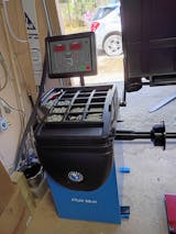
Got this KT-710G tire balancer and it is perfect for my needs as my garage is only 1 bay, this machine can be moved into place and moved back to its storage space. Assembly was straight forward and the tire calibration went as expected. I then balanced my calibration tire to zero. Very impressed with it overall. The Advantage Empire guys really took care of me with a discount and they worked with me on shipping. Overall a solid investment for my home garage.

Not much will beat this balancer. Shipped fast. easy to put together. Works right out of the case. Th only thing that beats this balancer is the customer service you get at The Advantage Empire. Nothing beats that. Thanks Obdi. We will work together soon.
David
Purchased a tire machine and wheel balancer. The balancer turned out to be defective. Obdi was behind me All the way getting it returned. I am ordering a replacement from him. If you are looking for auto equipment buy them from Obdi. He has your back if something goes wrong and will make a good deal for you.

easy to setup, fast delivery + best price, will definitely be shoppin here again

Quick service and, easy communication with the team
I had the best experience ever in the purchasing process. They were easy to deal with and very responsive to my questions.

great service and responsive team, happy with eveyrthing

This gaga provides everything our youth sports league needs in one area. It's robust, well-designed, and has held up perfectly to constant use.

great for search and rescue operations. It's robust and performs well in various conditions. Highly recommend.
