


Description
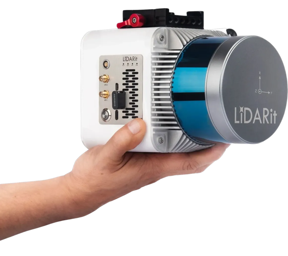
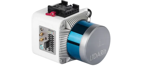
Unlock unparalleled spatial insights and elevate your land surveying projects with the LiDARit Enterprise Explorer R, Data Processing (SKU DN0004) – the ultimate turn-key LiDAR solution designed for diverse applications and exceptional accuracy!
The Definitive LiDAR System for Unprecedented Spatial Understanding
Are you a land surveyor, civil engineer, urban planner, infrastructure developer, or a non-profit organization, school, religious establishment, community center, apartment complex, or Homeowners Association seeking to capture highly accurate 3D spatial data, analyze critical features like road networks or building footprints, and generate actionable insights for your projects? Imagine effortlessly acquiring precise point clouds from up to 150 meters away, generating accurate contour lines, DTMs, and DSMs, and receiving tailored deliverables like CAD drawings, all from a multi-purpose system built for efficiency and reliability. The LiDARit Enterprise Explorer R is more than just a LiDAR scanner; it's a comprehensive turn-key solution that includes both cutting-edge scanning capabilities and powerful data processing services, empowering you to explore, analyze, and visualize your terrain and assets with breathtaking detail and unwavering confidence.
Benefits That Guarantee Accuracy, Streamline Workflow, and Deliver Actionable Insights
This isn't just a LiDAR system; it's a transformative asset for your operational superiority, offering:
- Capture Highly Accurate 3D Data from Afar: With a Max Range Reflectivity of 150m @ 20% and Laser Accuracy of 2cm @ 150m, the Explorer R enables you to capture exceptionally precise 3D point clouds, even from significant distances, ensuring every detail of your site is faithfully recorded.
- Generate Flawless Topographical and Terrain Models: Achieve a remarkable Point Cloud RMSE of 2.5cm @ 50m, allowing you to create incredibly accurate Contour lines, Digital Terrain Models (DTM), and Digital Surface Models (DSM), essential for detailed site planning, volume calculations, and environmental analysis.
- Receive Tailored, Ready-to-Use Deliverables: We offer a range of valuable deliverables tailored to your needs, including .TIFF, .CAD drawings, .DWG format, .LAZ, Point cloud, Contour lines, DTM & DSM. These comprehensive outputs empower you with the spatial information and tools necessary for effective mapping, analysis, visualization, and decision-making directly within your existing workflows.
- Unlock Deep Insights with Specialized Analytics Services: Go beyond raw data. Our expertise lies in harnessing spatial data to extract and analyze specific features such as road networks, pipelines, and building footprints. Gain in-depth insights for urban planning, infrastructure development, and asset management, transforming raw data into strategic intelligence.
- Empower Diverse Applications for Community Improvement: Whether you're mapping a new park layout, assessing infrastructure for an apartment complex, planning drainage for a school, or managing historical sites for a religious establishment, this system provides the spatial data and insights to make informed decisions that grow a sense of community and make lives better.
The Advantage of Multi-Purpose Versatility, High-Resolution Scanning, and Expert Processing
The LiDARit Enterprise Explorer R stands out with its intelligent design and unwavering commitment to comprehensive solutions:
- Multi-Purpose System: Engineered for a wide array of land surveying projects, the Explorer R is a truly multi-purpose LiDAR system, offering flexibility for various applications from basic mapping to complex feature extraction.
- High-Resolution Data Acquisition: Features 2 echoes and a Maximum Recommended Scan Height of 100m, ensuring comprehensive data capture and penetration through light vegetation for detailed ground models.
- Seamless Data to Insight Workflow: By offering both scanning capabilities and expert data processing services, LiDARit provides a seamless workflow from raw data acquisition to valuable, actionable insights, eliminating the need for separate vendors and streamlining your project delivery.
- Supports Industry-Standard Formats: Deliverables are provided in widely used formats like .TIFF, .CAD drawings, .DWG, and .LAZ, ensuring compatibility with your preferred software and systems.
- Expert Analysis at Your Fingertips: Leverage our specialized analytics services to extract and analyze specific features, turning vast point cloud data into focused, relevant information for critical planning and asset management.
Key Features for Comprehensive Land Surveying
- LiDAR Range: Max Range Reflectivity: 150m @ 20%.
- Laser Accuracy: 2cm @ 150m.
- Point Cloud Accuracy: RMSE: 2.5cm @ 50m.
- Echoes: 2.
- Maximum Recommended Scan Height: 100m.
-
Deliverables:
- .TIFF
- .CAD drawings
- .DWG format
- .LAZ Point cloud
- Contour lines
- DTM (Digital Terrain Model)
- DSM (Digital Surface Model)
- Services Included: Scanning capabilities and data processing for multiple applications.
- Optional Analytics Services: Specialized feature extraction for road networks, pipelines, building footprints, urban planning, infrastructure development, and asset management.
- Warranty: Manufacturer warranty included.
Invest in Unrivaled Spatial Intelligence with Absolute Confidence
Your investment in the LiDARit Enterprise Explorer R is fully protected by a comprehensive manufacturer warranty, providing you with complete peace of mind. At The Advantage Empire, we believe in creating spaces that grow a sense of community, and with the Explorer R, you're not just acquiring a LiDAR system; you're gaining the power to precisely map, analyze, and understand your environment with unprecedented detail, fostering informed decisions and enabling truly transformative projects that make lives better. As a leader in spatial data solutions, LiDARit empowers professionals and organizations to unlock the full potential of their land surveying projects. Contact us today to transform your data acquisition and analysis workflow!
Payment & Security
Your payment information is processed securely. We do not store credit card details nor have access to your credit card information.
Let customers speak for us
purchased two NT-9s ancalled me straight away to confirm details. Arrived in a few days with tracking! need to order 1 more lift from advantage empire guys, keep up the great work
- eyde

It is everything we expected. Works great.

Ry was great to work with. Fast delivery and excellent follow-up. Would definitely recommend. We hope to do business again in the future.
Looks great. Haven't set it up yet though.

Atlas 10,000 lb Overhead 2 Post Lift SKU ATEXH-PV10PX

Couldn't be more pleased, great service and attention to shipping updates. Equipment excelent and easy to set up. Great fo home use. Delivered in just a few days.
Got this KT-710G tire balancer and it is perfect for my needs as my garage is only 1 bay, this machine can be moved into place and moved back to its storage space. Assembly was straight forward and the tire calibration went as expected. I then balanced my calibration tire to zero. Very impressed with it overall. The Advantage Empire guys really took care of me with a discount and they worked with me on shipping. Overall a solid investment for my home garage.

Not much will beat this balancer. Shipped fast. easy to put together. Works right out of the case. Th only thing that beats this balancer is the customer service you get at The Advantage Empire. Nothing beats that. Thanks Obdi. We will work together soon.
David
Purchased a tire machine and wheel balancer. The balancer turned out to be defective. Obdi was behind me All the way getting it returned. I am ordering a replacement from him. If you are looking for auto equipment buy them from Obdi. He has your back if something goes wrong and will make a good deal for you.

easy to setup, fast delivery + best price, will definitely be shoppin here again

Quick service and, easy communication with the team
I had the best experience ever in the purchasing process. They were easy to deal with and very responsive to my questions.

great service and responsive team, happy with eveyrthing

This gaga provides everything our youth sports league needs in one area. It's robust, well-designed, and has held up perfectly to constant use.

great for search and rescue operations. It's robust and performs well in various conditions. Highly recommend.
